
TANG-E LILI (LILI GORGE): GALLERY
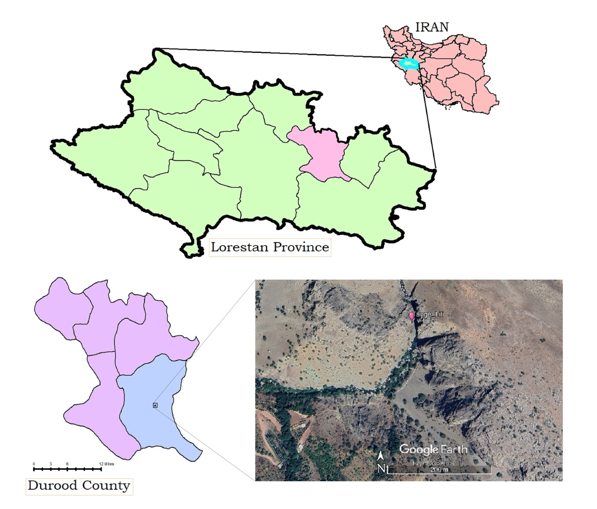 Map prepared by Abbas Nouri using Google Earth imagery. Annotations/adaptation © Abbas Nouri. Google Earth Image © 2025 Airbus, Map Data © 2025 Google. Used in accordance with Google Earth attribution requirements
Description: Lorestān province, Dorūd and Tang-e Lili in western Iran
Author/adaptation: Abbas Nouri
Copyright: © Abbas Nouri for annotations/adaptation
Source: Maps at the top and bottom left, provided by Abbas Nouri. Map at bottom right, adapted from Google Earth imagery. Google Earth Image © 2025 Airbus, Map Data © 2025 Google
Terms of use: Reuse requires permission from the author and compliance with Google Earth attribution requirements
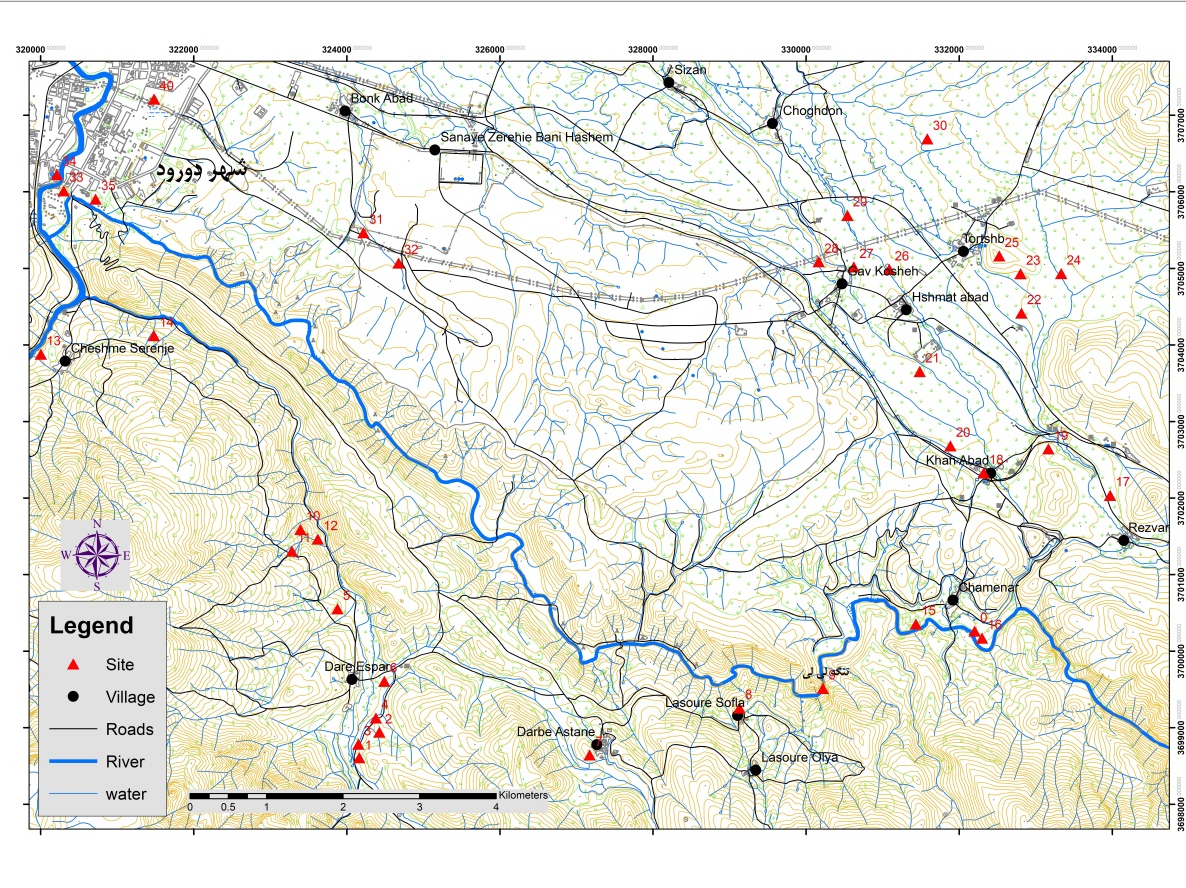 Courtesy of Abbas Nouri
Description: Topographic map of Silakhor Plain, Dorūd County. Seleucid and/or Parthian period sites identified along the Mārbara River
Author/cartography: Abbas Nouri Copyright: © Abbas Nouri for cartography
Source: Cartography courtesy of Abbas Nouri
Terms of use: For any reuse of the image explicit authorization must be obtained from the authors of the entry
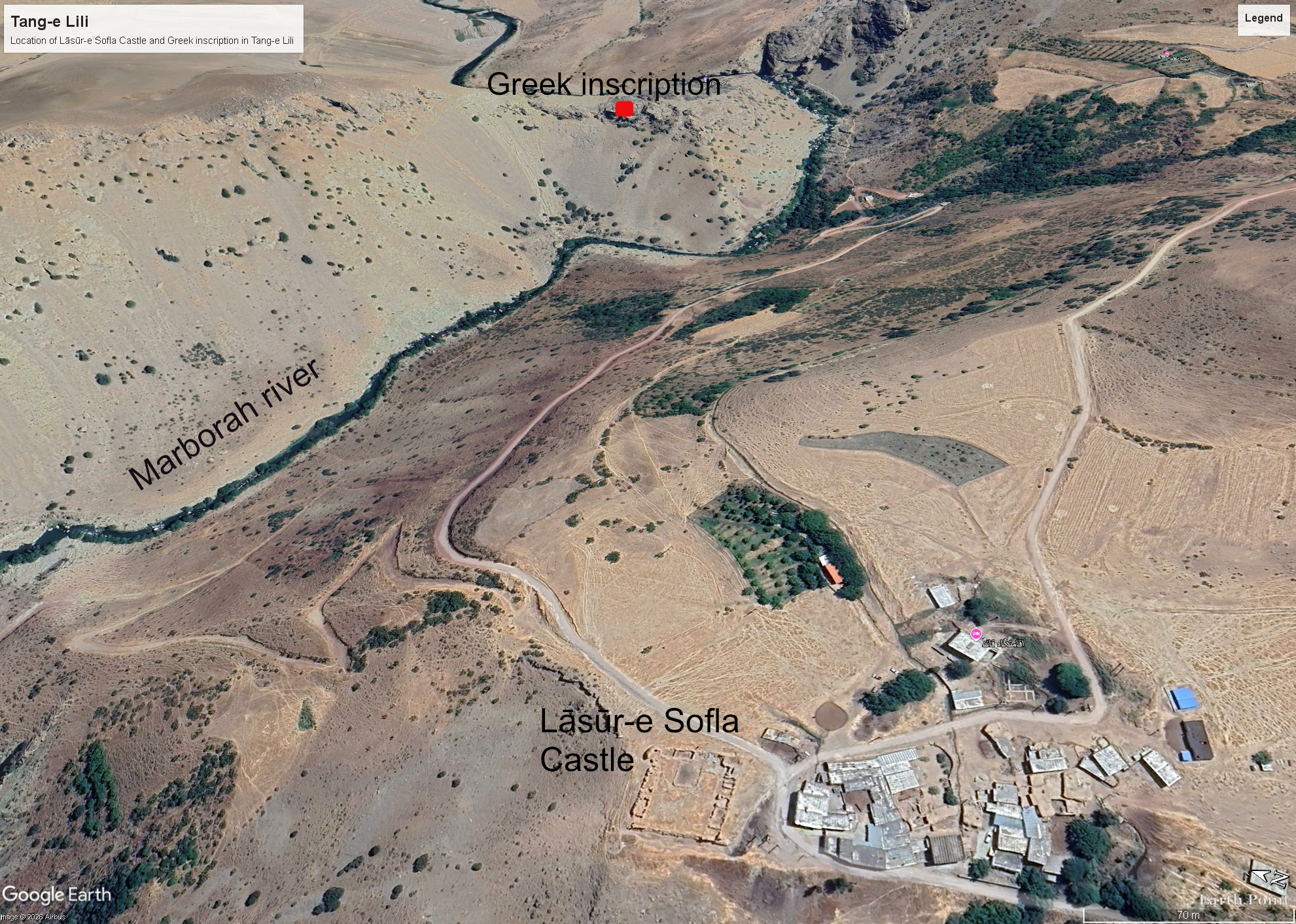 Map prepared by Seyed Abazar Shobairi using Google Earth imagery. Annotations/adaptation © Seyed Abazar Shobairi. Google Earth Image © 2026 Airbus, Map Data © 2026 Google. Used in accordance with Google Earth attribution requirements
Description: Location of Lāsūr-e Sofla Castle and Greek inscription in Tang-e Lili
Author/adaptation: Seyed Abazar Shobairi Copyright: © Seyed Abazar Shobairi for annotations/adaptation
Source: Adapted from Google Earth imagery. Google Earth Image © 2026 Airbus, Map Data © 2026 Google
Terms of use: Reuse requires permission from the author and compliance with Google Earth attribution requirements